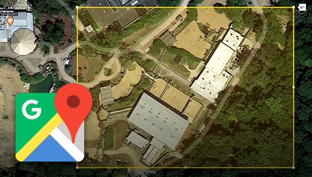
Redline Planroom and Takeoff, our powerful cloud-based markup and takeoff tools just got even better. Now you can import detailed aerial views from anywhere on the globe through the newly enhanced Google Map import sequence. Simply enter an address, choose the area to scan, and pull it into Redline for markup or takeoff.
- Scan any area worldwide with powerful Google Map integration
- Adjust image rotation from 0-360 degrees
- Add your scanned images to version sets for easy organization
- Calculate roof areas, valleys, hips and more with Redline Takeoff
Google Maps is the most popular navigation app in the world, with coverage over 99% of the globe, across more than 200 countries & territories. Users of Google Maps contribute more than 20 million pieces of information every day, and this information - combined with Google Street View, machine learning, and authoritative data - makes Google Maps the most up-to-date GPS reference available, as attested by the 1 billion active monthly users.
Combining the power of UDA's plan markup & management tools with Google's extensive satellite and aerial imagery, construction pros will discover impressive jobsite visibility like never before!
UDA Technologies continues to be one of fastest growing providers of construction productivity software, currently serving more than 750,00 construction professionals in the United States, Canada, Australia, and 75 countries worldwide with double-digit, industry-leading revenue growth year to year.
To learn more about the enhanced Google Maps import sequence, or any other feature designed to help your business, please contact a UDA Product Specialist at 1.800.700.8321.